Challenge 1: Leveraging emerging digital technologies to strengthen water security with Managed Aquifer Recharge
MARSite: AI-Based Evaluator for Potential Managed Aquifer Recharge (MAR) Sites

TL;DR
Finding the ideal geographical MAR site is complex, costly, and lengthy, even for large teams. We wanted to facilitate this process and help them find the best candidate locations for building MAR sites, so we created the Managed Aquifer Recharge Site Search (short for MARSS) tool: the MAR site finder.
Before we get into it, what is MAR?
To simplify things, I will take a quick example of myself.
Growing up as a kid, I would spend every summer with my grandmother in a small city in Mongolia. There, my grandmother owned an electrical water pump, which would extract the water from beneath the ground. We used this water for direct consumption and irrigation as my grandmother loved planting trees, and vegetables.

Back then, we relied on groundwater for our consumption and irrigation.
And there are over 2.5 billion people who rely on groundwater like I used to do. Almost half the total water for irrigation comes from the groundwater.
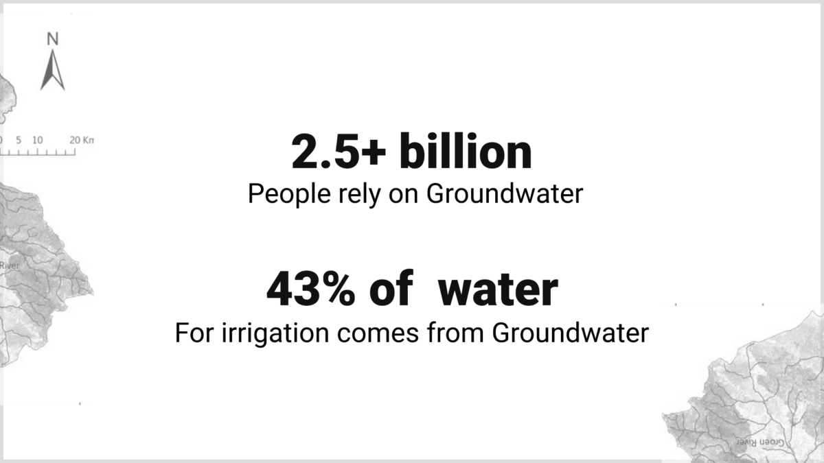
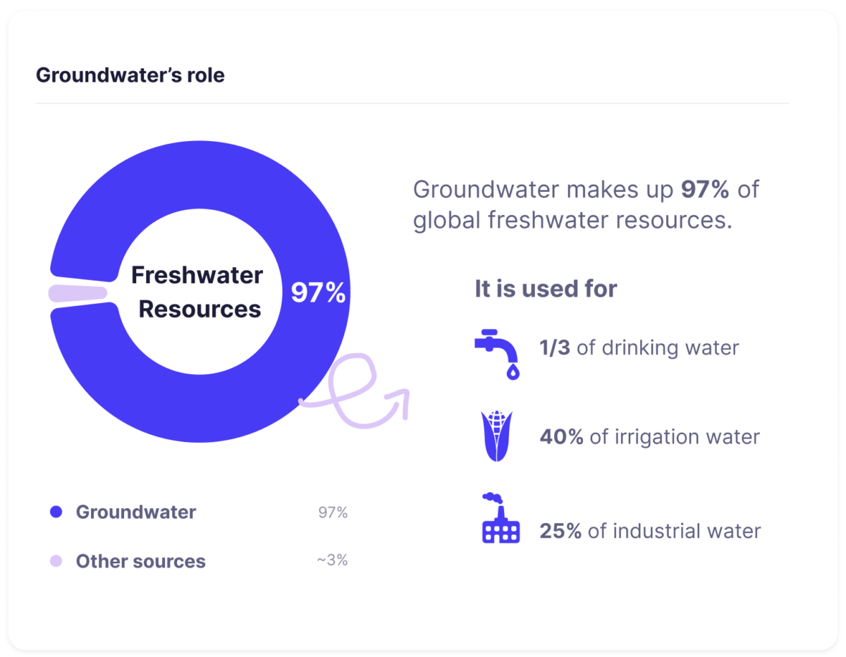
Source: WORLD BANK [3]
Groundwater is amazing. All good to go, or NOT?
There’s an impending problem that affects the groundwater. The problems are
- The ground holds a finite amount of water: Prolonged excessive usage of water from the ground can deplete the resource.
- Population growth: With the increasing population on earth, more and more water demand is created in every aspect of our lives.
- Climate change: The unpredictable events of the weather can adversely affect the water quantity and quality.
A recent comprehensive study published in Nature reveals that groundwater is rapidly depleted across numerous global aquifers.

And that’s where MAR(Managed Aquifer Recharge) comes in
To keep groundwater usage sustainable for the future, there should be just as much water coming into the ground as it is being extracted. To manage this process, and keep it sustainable for the future, the MAR(Managed Aquifer Recharge) method is used.
Managed Aquifer Recharge (MAR) is a cost-effective and efficient method for managing groundwater. It involves intentionally replenishing aquifers using natural methods (like infiltration basins) or engineered solutions (such as injection wells). MAR addresses groundwater depletion by storing excess water during wet periods, which can be used in dry times, reducing evaporation losses expected in surface storage [5].
Key benefits of MAR include:
- Cost-Effectiveness: Lower implementation costs compared to other methods.
- Reduced Evaporation Losses: More efficient in conserving water than surface reservoirs.
- Increased Water Supply: Enhances agricultural, industrial, and domestic water availability.
- Groundwater Stabilization: Mitigates issues like declining water tables and land subsidence.
- Versatility: Can utilize various water sources, including stormwater and treated wastewater.
But… again

Everything so far sounds great. However, creating a sustainable MAR site presents several pressing challenges. MAR construction process generally follows the following steps.
- Preliminary Investigation: To conduct an initial study to determine how suitable the land is for constructing the MAR site
- Planning and Design: Develops detailed engineering specifications, calculates aquifer storage capacity, and conducts comprehensive financial feasibility analysis
- Construction and Testing: Builds recharge infrastructure, installs monitoring systems, and validates performance through controlled injection trials
- Operations: Maintains optimal system performance through scheduled maintenance, real-time monitoring, and rigorous water quality control protocols
Each one of the steps poses its own unique set of challenges. However, after going through some work reports, research, and literature, we decided to focus on Preliminary Investigation. We did it because we realized that the initial investigation phase incurs a huge potential bottleneck for the MAR projects.
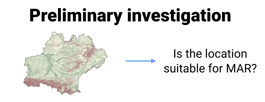
Preliminary investigation challenges
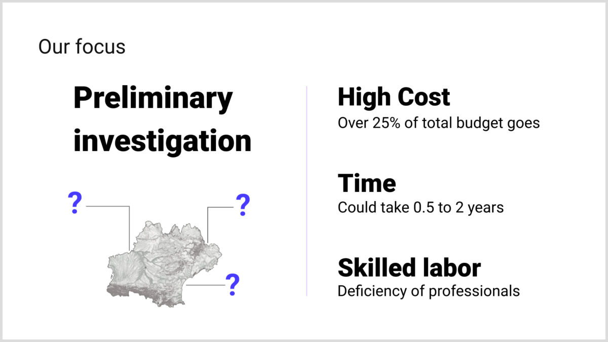
Preliminary investigation poses several challenges. The main challenges we are interested in addressing are:
- Cost: Over 25% + of capital alone is spent on investigating the suitability of the MAR sites.
- Human Resources: Insufficient skilled Human Resources to produce a sound technical assessment
- Time: It takes several months to wrap up the investigation depending on the location circumstances
How we address those issues
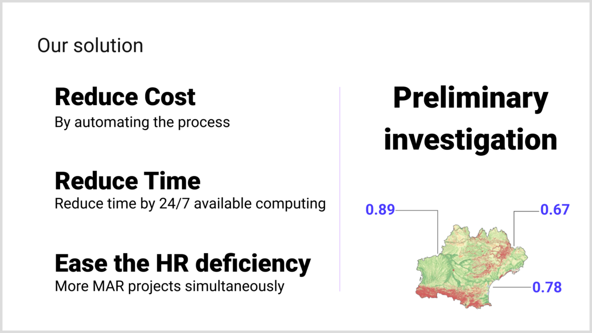
To address the previous issues in the preliminary investigation stage, we propose the AI-based MAR site evaluator. Using the evaluator, the particular land of interest will be analyzed and assigned a suitability score for constructing the MAR site.

We would address the issues by making the:
- Cost reduced: The cost will be significantly reduced so people can get started and move quickly
- Ease Human Resources deficiency problem: Overcome the difficulty of finding skilled people
- Reduce Time taken: Save time and resources
How things work currently
Currently, industry experts use a number of advanced software tools to simulate, analyze, and make a decision on the suitability of a location for the MAR site. Furthermore, using the supporting data, they oftentimes employ advanced mathematical analysis methods to determine suitability scores. One of the most prominent ones is the MCDA (Multi-Criteria Decision Analysis) technique called ANP (The Analytic Network Process). For those who are interested, we have an explanation of how this method works underneath.
Those advanced methods still require professionals who are capable of using those advanced software tools and conducting mathematical analysis. Our solution will help ease this requirement, and provide users with analysis results.
Example analysis method: ANP (The Analytic Network Process).
This example will be primarily focused on an MCDA (Multi-Criteria Decision Analysis) technique ANP (The Analytic Network Process).
Initially proposed as a generalization of the Analytic Hierarchy Process (AHP), another Multi-Criteria Decision Analysis (MCDA) technique, the Analytic Network Process (ANP) is a systematic method used to break down a problem into its constituent components [7]. The ANP follows a holistic approach where all influencing criteria, along with their potential dependencies, are organized in a network structure (Fig. a).

Utilizing the ANP can be broadly divided into two steps: the network creation and network analysis.
The network creation: At this stage, the primary goal is to structure the initial problem to identify the overall goal, sub-goals, criteria, sub-criteria, and alternatives, if any. These elements are then grouped into clusters based on their common themes, creating clusters of related elements. Finally, any dependencies between different clusters, as well as within the elements of the same cluster, are identified and represented with arrows. Arrows with the same source and destination, known as loops, indicate internal dependencies within a cluster.
The network analysis: At this stage, the network is analyzed both analytically and empirically. Particularly, the Markov-Chain process is used on a stochastic supermatrix formed from the eigenvalue analysis of some smaller matrices, which are obtained empirically. (Yes, the previous sentence probably did not make any sense to you, but no worries since the main message is some mathematics is used here.) Empirical here means someone will be using their gut feeling to assign some scores based on comparisons between elements.

Although ANP can be quite complex if one intends to understand the topic at a low level, it is helpful to mentally model it as a kind of black box.
ANP as Blackbox: In essence, ANP takes input from various criteria, alternatives, their interdependencies, and a good measure of a gut feeling as mentioned. The internal mechanics of the ANP method consider these interrelationships, performing complex calculations to determine how the influence of each criterion propagates throughout the network. The output—the array of fractions—provides a prioritized ranking of the criteria, allowing decision-makers to understand which factors carry the most weight in reaching the desired outcome. The system works seamlessly, producing these weights even when the network structure is intricate and the interdependencies are non-linear.
Returning to the MAR site suitability issue, completing the network creation process is sufficient for us, as network analysis can be handled by software programs like Super Decisions. Therefore, we propose the following network based on a review of the scientific literature on MAR (Fig. b).
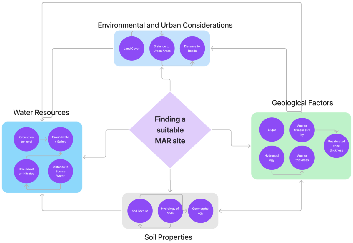
The proposed network consists of nodes representing the overall goal of finding a suitable MAR site and four distinct clusters, each containing several criteria that share a common theme. The arrows emerging from the goal indicate that it is influenced by the four clusters: soil properties, water resources, geological factors, and environmental and urban considerations. Within these clusters, there are also internal dependencies, meaning some criteria are interrelated. For example, an arrow from aquifer transmissivity to unsaturated zone thickness suggests that aquifer transmissivity—which depends on its hydraulic conductivity and thickness—can mean something about the thickness of the unsaturated zone by dictating how quickly water moves through the system. Similarly, the distance to urban areas influences the distance to roads, as proximity to urban areas often correlates with the proximity to roads.
In Summary, users will only need to specify the geographical location area to determine its suitability for the MAR site. The analyzer will take care of the complex relationship between the area’s different unique features, slopes, soil texture, etc…, and show the users which areas are most suitable for building MAR.
Note: For more in-depth treatment of the theory behind ANP, please check out [7].
How our solution works
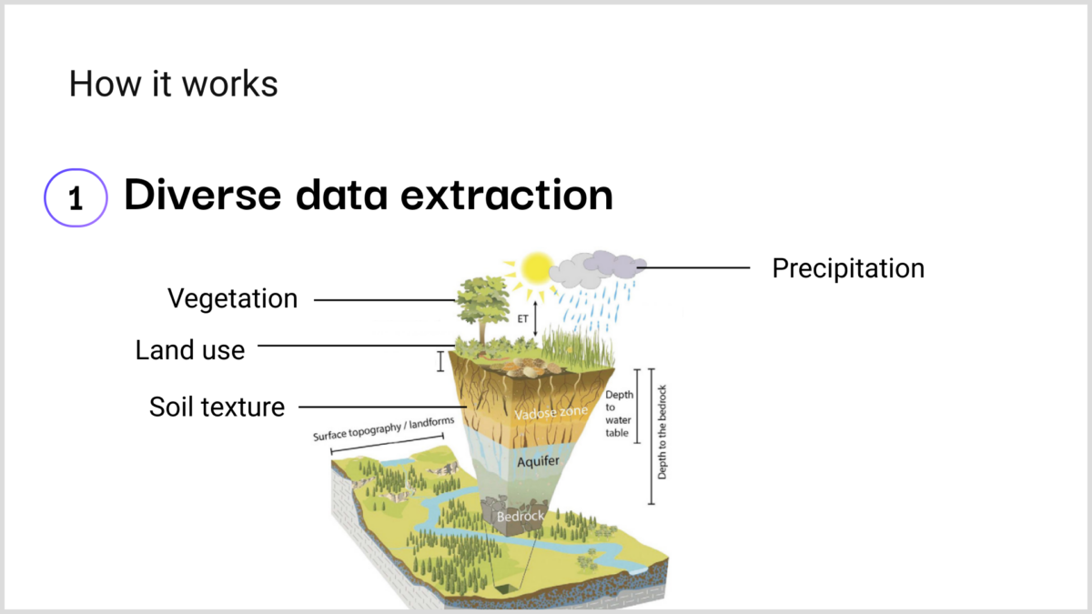
Step 1: Data Integration & Analysis
We collect and analyze a variety of location-based data. Our system identifies correlations among various geographic and demographic features.
- Our system identifies correlations between multiple geographic and demographic features
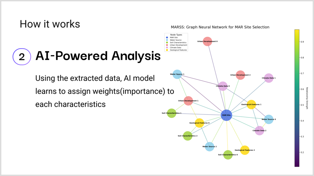
Step 2: Feature Relationship Modeling
We chose Graph Neural Networks because they offer unique advantages that are particularly well-suited to the complex nature of MAR site selection
- Capturing Spatial Relationships: MAR site suitability isn’t just about individual site characteristics; it’s about how a site relates to its surroundings. GNNs excel at modeling these spatial relationships.
- Handling Heterogeneous Data: MAR site selection involves diverse data types – geological, hydrological, climatic, and land-use data. GNNs can naturally integrate these heterogeneous data sources into a single, coherent model.
- Modeling Complex Interdependencies: The factors affecting MAR site suitability are highly interdependent. GNNs can capture these complex, non-linear relationships.
- Handling Missing Data: In real-world scenarios, we often face incomplete data. GNNs can make inferences about missing data points based on neighboring nodes and overall graph structure, making them more robust to incomplete datasets.
- This helps us understand the relative importance of each feature in predicting optimal locations
Step 3: How it looks in action
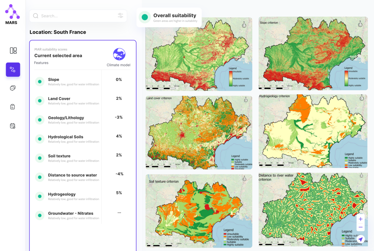
Users will be able to specify the geographical area they would like to analyze for MAR suitability and get the answers right away.
Users will be able to view a combined suitability score of MAR displayed on a map, along with individual maps showing the suitability scores for each feature.
Business model
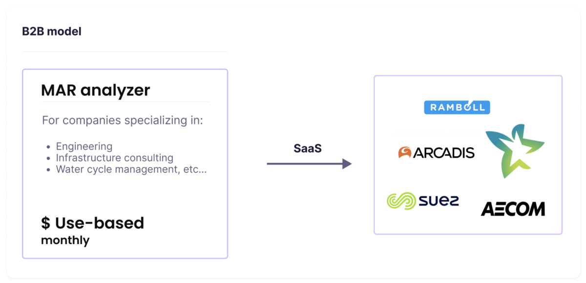
Our target customers will be companies that specialize in Engineering, Infrastructure consulting, and Water cycle management as well as government tenders. We will offer our solution as SaaS for them to use as an analytical tool. Through our solutions, users will be able to facilitate their work progress, save costs, and gain a competitive advantage.
Each user is unique. And since our solution’s main driving dynamic cost will be the computing resources, the users will be charged based on the computing resources they have used through the analyzer.
Team
Our team comprises diverse individuals with significant experience in software development, AI&ML engineering, and mathematics.

References
[1] https://gw-project.org/the-importance-of-groundwater/
[2] https://www.un.org/en/global-issues/population
[3] https://www.worldbank.org/en/news/infographic/2022/03/23/groundwater-vital-but-invisible
[4] Jasechko, S., Seybold, H., Perrone, D. et al. Rapid groundwater decline and some cases of recovery in aquifers globally. Nature 625, 715–721 (2024). https://doi.org/10.1038/s41586-023-06879-8
[5] Alam, Sarfaraz, et al. “Managed aquifer recharge implementation criteria to achieve water sustainability.” Science of the Total Environment 768 (2021): 144992.
[6] https://research.csiro.au/mar/
[7] Ishizaka, A., & Nemery, P. (2013). Multi-criteria decision analysis: methods and software.
