ENHANCING CLIMATE RESILIENCE IN REMOTE COMMUNITIES USING DATA AND TECHNOLOGY
CASE STUDY: MANDERA COUNTY
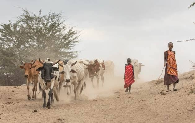
Mandera County faces significant challenges due to its high vulnerability to droughts, heat stress, moisture stress, and floods. These environmental hazards severely impact the production, storage, and sales of both agricultural and livestock products, putting the community’s livelihood at risk.
PROBLEMS
- Insufficient Resources and Information
- – The community struggles to cope with climate impacts due to limited knowledge.
– Aid providers are less effective because they lack the necessary information to offer adequate support.
- – The community struggles to cope with climate impacts due to limited knowledge.
- Inadequate Support for the Most Affected
– The response to those most impacted by climate change is often delayed, and communication is poor, largely because these communities are in remote locations with limited information and resources.
The above problems are manifestation of low resilience.
OVERVIEW
There is a clear gap in resources and real-time information for both humanitarians and the local community. The community’s lack of information leaves them vulnerable to the impacts of climate change, while humanitarians face difficulties in providing effective assistance due to inadequate knowledge and diminishing access to essential resources. This leads to a delayed and often ineffective response to those who need help the most.
GOALS
- Gather and distribute crucial resources and information.
- Provide targeted support to those most affected by climate change.
- Ensure the community receives timely and practical information to strengthen their resilience.
- Equip humanitarians with the tools they need to offer additional support.
Note: Our approach prioritizes scalable and sustainable solutions using accessible technologies. The focus is on timeliness, enhanced preparedness, and building long-term resilience.
REQUIREMENTS
1. Warning Systems and AI-Based/Algorithmic Solution:
– Support sustainable practices like avoiding routes that could harm the environment.
– Anticipate climate-driven crises by predicting hazards.
– Estimate how long herds can stay in one area and identify where they can find water and food.
– Calculate the best timing for herd movements to minimize environmental damage.
– Awareness and Vegetation Restoration Program:
– Raise awareness and implement a program to restore pasture by dispersing seeds as herds move. Additionally, suggest water center locations to reduce movement and environmental impact, promoting long-term stability.
2. Suggest Market Location and Provide Better Route:
– Identify the best market locations and suggest efficient and safe routes to access them.
3. Manage Conflicts:
– Build strong relationships with farmers and other stakeholders, tracking these in the system.
– Monitor and map routes near farms and conflict-prone areas to warn herders.
4. Digital Data Collection Tools:
– Collect data from the community and integrate it with existing data models for better decision-making.
DIGITAL SOLUTION: RAPAS
- R: Remote
- A: Area
- P: Pastorals
- A: Assistance
- S: System
We have created a technical solution designed to assist pastoral communities using advanced models and algorithms. This solution captures and analyzes real-time data from community activities, such as movement patterns, feeding habits, and conflicts using a special device simply designed for easy usage. By processing this data, the system provides timely insights that help in guiding pastorals’ decisions which in the long run will promote climate resiliency. Moreover, the solution features an admin portal that allows humanitarians to access detailed, real-time information, enabling more effective interventions and support where it is needed the most.
System structure
Our system consists of two parts: A physical data collecting device empowered with a two-directional flow of communication (duplex system) using LORAWAN technology, and a web portal that will be used by humanitarian staff to get real-time information.
Device technology
Due to remoteness nature of pastoralism and specifically Madera County, internet access through Wi-Fi, GSM, 4G and 5G becomes a challenge. Also, the use of satellite can be expensive to be used by local communities. Therefore, this device utilizes important features that are workable in such conditions, some of these features are:
- LORAWAN network
- GPS technology
- Micro-controller
- Interactive features like LED, Buttons and Speaker
It also features Lora Gateways to connect and share data across the internet. These devices will be placed in local stations and will assist greatly in providing insights on climate, giving warnings and mass education by the humanitarians remotely, as well as serving as a gateway for communication.

Server and AI / Algorithmic Modules and Database
Working alongside the device is a central unit responsible for receiving and handling data, prediction, storage and processing incoming requests and then sending back the feedback or information to the endpoints which are the connected devices using gateways. The feedback aims at improving adaptation to various instances of climatic challenges and conflicts within the pastoral communities.
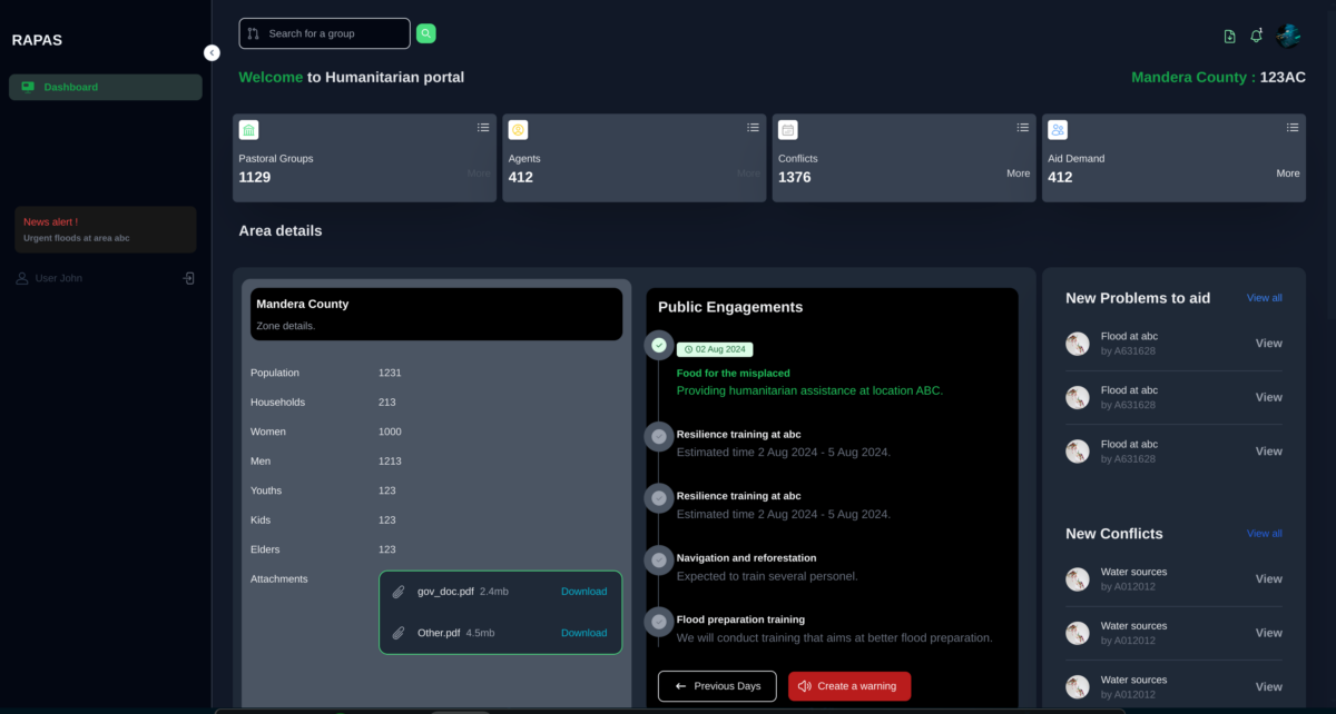
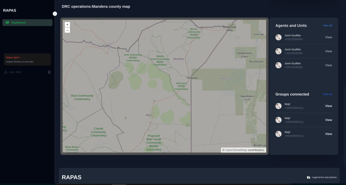
Humanitarian web portal
Dashboard is used by humanitarian groups to view real time activities and information such as navigation, conflicts and resources in order to enable possible intervention to the issues at hand. The Dashboard (Web portal) has insight on the following details.
- Pasture and Food
- Navigation
- Conflicts
- Agents
Marketing
The devices that will be made can be sold in other places to people who would want to use the product. Also, we insist on promoting programs through which pastoral participation will earn them some gifts and prizes or just points. An example of such a program is restoring vegetation.
Humanitarian dashboard screenshots
MEET US
A collaborative team of students from the University of Dar es Salaam, each pursuing different academic programs, who have come together to work on an innovative project. Being able to work on this project exemplifies the power of interdisciplinary cooperation in tackling complex global issues.